
THE BEST OF THE LOW WEALD
THE COUNTRYSIDE OF LANGLEY GREEN, ROWLEY
AND
HORLEY THREATENED BY THE PROPOSED
GATWICK SECOND RUNWAY
by David Bangs
Naturalist and author (bangs682@btinternet.com)
Naturalist and author (bangs682@btinternet.com)
 |
| Rush meadow, Willoughby Fields |
The countryside directly threatened by the proposal for a
Gatwick second runway is a patchwork of loved urban fringe green spaces,
ancient landscape features, and wildlife sites with huge ecological continuity
and cultural importance.
The countryside of the upper River Mole is a flat land, a
landscape of horizontals. This is the source of its tranquillity, its
restfulness. At its core it is punctuated only by curtains of tall trees (shaws) and their verticality brings a
feeling of dignity to the land, like the dignity of a civic hall, or an ancient
church, mosque, or temple. Calm restfulness and dignity...
these are the feelings which this Low Wealden countryside especially brings to
us. And in this vale of the Mole these landscape features – flatness, the
freely wandering river, the curtains of tall trees – are at their very best.
Nowhere else in the central Low Weald combines this
thoroughgoing flatness with this heavy timbering of ancient shaws to the degree
found in Langley Green and Charlwood’s countryside – not in the upper waters of
the Arun, the Adur, the Medway or the Ouse.
 |
| Wildwood relic – Small Leaved Lime on the Mole bank |
2. LANGLEY GREEN AND THE RIVER MOLE’S COUNTRY
The jewel in the crown of this countryside is the wooded River Mole
and the farming and recreational landscape of meadow and shaw that surrounds it,
north of Langley Green at Willoughby Fields, Amberley Farm, Bonnet’s Lane, and
Lowfield Heath.
2a. AN EXTRAORDINARY SURVIVAL: THE MOLE BANKS LINEAR WOOD
THE MOLE RIVER WOOD. Both banks of the river Mole between Ifield Avenue
Bridge and the Airport
perimeter road are graced by an archaic linear wood – over a mile long – which
supports many ancient woodland herbs and woody species. In our partial surveys
we have counted 23 such species of high indicative value, and this figure rises
to 26 with the inclusion of species growing in adjacent shaws. This linear
river wood has a scatter of Small Leaved Limes, a rare species of exceptional
indicative value.
ANCIENT WOODLAND PLANTS. Here is
the list of special ancient woodland species... Black Bryony, Bluebell, Bush
Vetch, Cherry (Gean), Crab Apple, Field Rose, Guelder Rose, Hart’s Tongue Fern,
Holly, Hornbeam, Maple, Midland Thorn, Moschatel (Dutchman’s Clock), Pendulous
Sedge, Pignut, Primrose, Ramsons (Wild Garlic), Remote Sedge, Soft Shield Fern,
Small Leaved Lime, Wood Anemone (Windflower),
Wood Club Rush, Yellow Archangel. Adjacent
shaws additionally have... Three Veined Sandwort, Wild Service
Tree, Wood Melick. There will be more we have missed...
‘FOSSIL MEANDERS’. This
stretch of the Mole retains many of its ancient
meanders, and others are ‘fossilised’ within
adjacent fields. The little ‘Oxbow Wood’ west of Amberley Farmstead, TQ 258/9
390, preserves such a ‘cut-off’ or ‘oxbow’ meander. There is Ramsons (Wild
Garlic) and Midland Thorn on the old banks, and Gipsywort in the mud of the
lost meander. The meadow next to (northeast of) the Oxbow Wood also has a
‘fossil’ meander preserved as a marshy depression. There is part of a ‘fossil’
meander within the Willoughby Field Nature Reserve, TQ 255 386. Mind the thorns
getting there! There are others both north and south of the river.
A NEW ‘COUNTY
OAK’. Part of the Mole bank at Amberley Farm, and the shaw that
runs from the bank behind the farmhouse, mark the historic county boundary. In
the shaw is a fine veteran Oak pollard on that boundary that passes muster as a
new
‘County
Oak’. Near to it is on the County boundary is the ‘Woodpecker Oak’, a fine
standard with a stack of at least four nest holes, noisily inhabited this year
by a Green Woodpecker family. The part of the Mole bank which lies on the
historic county boundary has a Small Leaved Lime maiden which could grow into a
‘County Lime’.

WALKING THE RIVER BED. It
is a magic place. The river-bed runs in a tunnel of trees between lush green
banks, hidden from view. Pools and shafts of sunlight make the lush greenery
glow and the rippling water twinkle. Beautiful Demoiselles (sort of Dragonflies
with blue/violet males and bronze females) flit across these watery glades. You
could be in the primeval wildwood, or the jungle. In the summer, when water levels
are low, it is possible to walk along large parts of the river bed. If you are
lucky a patrolling Kingfisher may flash by – a blue streak of light. You hear
the clatter of alarmed ducks starting away round the next bend. Parts of the
river bed are made of hard plates of rock which make sills over which the water
trickles in tiny waterfalls. Where the wet rocks are
exposed tribes of iridescent green White Tipped Signal Wing Flies hop about,
the males waving their wings frantically to attract the females... you’ve gotta
laugh. Elsewhere there is gravel, and you may find an old Duck Mussel shell. In
some spots there are ‘felt’ mats of the red rootlets of Willow and Sallow. On the damp, shaded banks
are primitive plants scarce changed from before the age of the dinosaurs:
Greasewort, Great Scented Liverwort, Dotted Thyme Moss, Harts Tongue Thyme
Moss.
2b. TOP ARCHAIC MEADOWS
 |
| Southern Marsh Orchid. Photo by Crystal Ray |
The cluster of unimproved and part-improved
meadows north of Langley Green is an extraordinary survival. Judged
conservatively, some 11 meadows survive in an archaic state and at least four
others have areas of archaic meadow vegetation. (The only archaic meadow
clusters on the Wealden Clay of the central Weald which approach that number of
fields are Burstow Meadows, NNW of Burstow church, e.g. TQ 308 418, and
Bedelands Farm Meadows, Burgess Hill, e.g. TQ 319 206, with 8 and 9 fields respectively.
The Burstow cluster is also at risk from the thrust of development of the
Gatwick corridor, and the Bedelands Farm LNR may well be surrounded by new
built development, if current plans come to fruition.)
The extant meadows of Amberley Farm tend to a
different character from those around Willoughby Fields. The Amberley Farm meadows are traditional hay meadows, some with great colour and
diversity of wild flowers. The rare Southern Marsh Orchis – glowing carmine red
– was present this year, with Spotted Orchis, Grass Vetchling (also carmine
red) and much colour from Vetches, Trefoils, Clovers, Knapweed and Buttercups.
There are many kinds of grasses, too. Sweet Vernal Grass dominates in springtime,
and Yorkshire Fog and Bent Grass in high summer.
The Willoughby Fields meadows are largely wet rush pastures, with much Soft Rush and
Compact Rush, Yorkshire Fog, and Creeping Buttercup, as well as Ladies Smock
(Milkmaids), Common Spotted Orchis and Oval Sedge. The colours modulate though
yellow and coppery greens, browns, dark, almost Prussian greens, fawns and leaf
greens, splashed white from Dropwort umbels and yellow from Trefoils and
Buttercups. There is a small and jewel-like fragment of old flower meadow in
the crook of a Mole meander at TQ 255 388, with Yellow Rattle, Crosswort and
much Bird’s Foot Trefoil. Several riverside meadows are succeeding to woodland,
though archaic grassland survives within one of them.
There are Green Veined White butterflies in spring and
Common Blues, Browns and Skippers in summer. In the damp winter you may see a
ghostly white Egret on watch. Several of the Willoughby Fields meadows have a pattern
of parallel gullies, perhaps from past drainage attempts, or past cultivation.
Some of the fields are corrugated by irregular depressions,
perhaps from lost ponds, drainage channels or even diggings. There are old farm
ponds in several field corners, now vegetating up, but with Flote Grass, tadpoles,
Water Crowfoot and Marsh Bedstraw still present. Two of the Willoughby Fields
Nature Reserve meadows are managed as rugby pitches (as are two more outside
the reserve), but their boundary shaws are respected, and one has old meadow
along its margin with special wildflowers, like Pignut.
2c. SHAWS AND THE ANCIENT FIELD PATTERN
The ancient field pattern of outgrown hedges and shaws
around the Mole and the Langley Green Brook has been preserved intact to a very
high degree. In the areas of Willoughby Fields and Amberley Farm this field
pattern is almost wholly intact, ‘preserved in aspic’ despite the passing of at
least 140 years (in this area a copy of the circa 1870 First Edition Ordance
Survey map, six inch to one mile, could be laid over the current Ordnance Survey
map and the two would match exactly over large parts. and probably much longer.)
These shaws support stands of the handsomest maiden Oaks,
and much Ash and Maple. Their understory is of Hazel, Blackthorn, Hawthorn, Holly
and Sallow. They support, too, scarce Wild Service Tree, Midland Thorn, Crab
Apple, Hornbeam, Guelder Rose and Field Rose. The scarce Brown Hairstreak,
whose caterpillars live on the abundant Blackthorn, and Speckled Wood, are their
special butterflies. In springtime they have abundant Bluebells and are
daisy-white with Greater Stitchwort. Then they are full of the music of Song Thrush
and Warblers, Nightingale, too, occasionally. Yellowhammers breed there.

3. LOWFIELD HEATH: AN INTACT ENCLOSURE
LANDSCAPE
Lowfield Heath largely preserves the pattern of field,
hedge and shaw laid down at enclosure of the common in 1846. The sub-landscape has escaped all the stripping out of these
features which most large scale enclosure landscapes (as in eastern England)
have catastrophically suffered.
The field edge trees commonly date from the post-enclosure
decades, and strips of post-enclosure mixed woodland have grown up to enrich
this picture. Much of the footprint of the old common is tilled productively.
Just beyond the south end of Poles Lane, TQ 265 391, is an area of
much older tiny fields (crofts). They were probably enclosed
from Lowfield Heath Common circa 1700 or earlier – some 150 years before its
main enclosure, for County Oak Cottage, there, is dated 1705, and its barn may be even older.
Wild Service Tree and Hornbeam are present in the hedgerows
and shaws, with fine Oaks. The fields are largely managed for hay and for horse
grazing. The boundaries of the old common can
be traced in part from the location of the pre-enclosure farms and cottages, once located on the common’s edge, but now set back from
the ruler-straight surveyor’s roads: – Charlwood
House (17th century), Spikemead Farmhouse (1604), Poles Acre Barn (17th
century), County Oak Cottage (1705 or before), Gatwick Manor (15th century).
At least one field gives us a flavour of the vegetation of
Lowfield Heath common before its 1846 enclosure. Lowfield
Heath Rush Pasture, TQ 269 392, lies just west of the A23 and northeast of
Little Dell. It has a Sallow fringe, with large patches of Tufted Hair Grass,
Soft Rush, and Sweet Grass within a matrix of shorter sward, with Creeping
Buttercup and Cinquefoil. It is flat, but with shallow corrugations, and very
wet in winter.
4. ROWLEY FARM AND CRAWTER’S BROOK’S COUNTRY
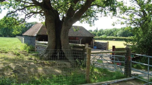 |
| Pollard oak, Rowley Green |
Rowley Farm, TQ 279 396, sits on a mountain, for that is how its low
hill, 77m/252ft high, feels in all the placid horizontality of the Vale of the
Mole.
Though it is only some 17m/56ft above the level of the airport
runway its winding ascent opens up fine views beyond the Airport to the wooded
Weald as far as the scarp of the North Downs...
and to nearby Lowfield church spire, otherwise hidden from nearer view by tall
airport clutter.
Rowley Hill is a viewpoint that re-connects the viewer to the wider
and older landscape... to the earlier and more profound geographies of river floodplain,
wooded Weald and the embrace of the chalk downs. This is a viewpoint to be
celebrated, not further eroded or destroyed.
Much that is ancient survives at this place. Both north and east of
the Farm the ancient boundaries of Rowley Green can still be traced by fences
and trees, and a paddock east of the Lodge, TQ 278 399, retains a smidgeon of
the Green’s archaic vegetation.
In front of the hovel opposite the Lodge are two fine veteran Oak
pollards, both hollow and spilt, but in rude health. There is a further pollard
Oak of great character – burry and gnarled – on the hilltop where the farmhouse
north drive splits from the bridleway. The timber framed Farmhouse, TQ 279 396,
is Elizabethan – perhaps 450 years old – and the weatherboarded Great Barn is
even older – late medieval. The Row‘ley’ (woodland glade) place name (in
the countryside at risk from a second runway are a cluster of ancient ‘ley’
place names, which have this meaning of an ‘open space within extensive
woodland’: – Langley, Amberley, Tinsley, Rowley,
Horley. They demonstrate that large scale ancient woodland survived very
late in this area.) indicates the erstwhile presence of tracts of ancient
woodland, from which, perhaps, first the Green and then the tilled fields were
carved.
The field pattern is mostly intact to the east, but has been lost on
the west slope of the hill. Huntsgreen Wood, to the northeast, TQ 283 399 is
ancient, with fine Oak standards. It is a classic wet Wealden Clay wood, with
much Bramble and Nettle, perhaps because of previous grazing. Rowley Wood, to
the south, TQ 279 392, is also ancient. It is a Bluebell wood of Oak, Ash, and
Birch, over Hazel coppice, and with some Sweet Chestnut. It is an SNCI (Site of
Nature Conservation Importance).
West of Crawter’s Brook, e.g, TQ 274 394, the old pattern of hedges
and shaws is almost intact, with views north across the Oaks and Ashes to the
spire of Lowfield
Church. It is a
delightful place. Part of the land is cattle grazed (from Rowley), part is
horse pasture and hay meadow, part is mixed woodland, part
is the lovely grounds of Gatwick Manor, and part is business parking. At least
one Rushy Pasture,
TQ 273/4 395/6, has a high level of naturalness, with Cutleaf Evergreen
Blackberry (big, juicy, extratasty berries), Male Fern, Fleabane, St John’s
Wort, and Bird’s Foot Trefoil. The shaw along its eastern boundary has Crab
Apple, Midland Thorn, Maple and Sloe. At its north end, abutting the Airport Perimeter Road,
a fossil meander of the straightened Crawter’s Brook is visible, with Spotted
Orchis and other old meadow species.
5. CHARLWOOD ROAD AND BONNETS LANE’S
COUNTRY
5a. BONNETS
LANE’S COUNTRY
Though Bonnet’s Lane can be busy with traffic it
still retains the character of a winding Low Wealden lane, shaded by shaws, an
ancient wood, hedgerows and trees.
At the Lane’s southern junction with Charlwood Road is Stafford Green, TQ 250 384/5, which still, in part, retains its archaic wet
pasture vegetation. It is a remarkable survival of the once-continuous roadside
‘waste’ between the two linked commons of Ifield Wood and Ifield Green. In
spring it is decorated with Ladies Smock/Milkmaids (and Garden Daffodils!) and
in early summer its western side has a lovely display of Marsh Woundwort and Meadowsweet,
Codlins and Cream and Water Dropwort, with much Spiked Sedge.
To the east of Bonnet’s Lane are sheep and horse
pastures dropping gently down to the Mole. Many of the fine old hedges survive.
Many of the fields are Buttercup meadows, and, near to the Mole and the scrambler
bike trail, the meadows have much Grass Vetchling.
At the south end of the Lane, just east of
Stafford House, is a brook meadow, TQ 252 384, with old anthills and fine
150-200 year old Oaks on its northern boundary. Just to the north, between the Bonnet’s
Lane houses and the river is a wooded-over brook meadow and cut-off meander, TQ
254 387, a fine bird refuge, sheltering an especially secluded length of the
Mole.
Bonnets Copse, TQ 253 390, is an ancient Bluebell
wood, with many shallow pits, making a wet, irregular surface. There are many
young Oak standards and scattered Hornbeam stools, a peppering of Scot’s Pine,
and a good sub-shrub layer of Bramble, with abundant Blackthorn and Broad Buckler
Fern.
At the north end of Bonnet’s Lane, just over the
old county boundary into Surrey, is an archaic Rushand-Tufted Hair Grass
pasture, TQ 253 395. Once probably part of the old Westfield Common, it gives
some indication of that common’s historic vegetation.
Wet and tussocky, it has big Tufted Hair Grass swarms, Spiked Sedge, Compact
and Soft Rush, Tall Fescue and Water Dropwort. Water Mint is fragrant
underfoot... A lovely wild place.
5b. CHARLWOOD ROAD’S
COUNTRY
 |
| North of Charlwood Road: swallows, rooks, martins, skylarks |
North of the Charlwood Road, between Bonnet’s Lane and the Ifield
Road, is the site of the late medieval Ifield Deer Park, commemorated by the Little
Park Farm place name. Enclosed by the late 17th century, its site has
since been an area of small fields, wooded shaws and hedges, with secondary woods
now of a good age.
West of the airport runway many of these old landscape features have
been lost to modern agribusiness in recent decades, but to the south the
majority are still intact.
The mansion of Ifield Hall is now demolished, but its parkland and
outbuildings are partly intact, with some archaic grassland south of the drive,
TQ 250 387, and a fine three span girth veteran Oak to its north, as well as
mature shaws along the Charlwood Road and Bonnet’s Lane.
Just north west
of the old Hall is Ifield Hall Wood, TQ 248 390. Perhaps a century old, this
wood has mature mixed plantings of Oak, Lime, Horse Chestnut, Beech, Sycamore and
Maple, with small numbers of other species. Plainly much loved, it is used for
woodcraft activities.
Bluebells are ingressing from the western footpath, thus showing
that that path may once have been linear old woodland. Furze Field, TQ 246/7
391, is a low wood, thus demonstrating its scrubby origins. It had small Oaks,
Ash, Spindle, and Blackthorn, and its boundary ditches have Yellow Flag, Marsh
Thistle and Marsh Bedstraw.
The enclosed fields along the Charlwood Road are horse pastures, and
the fields to the north are part sheep pastures, part tilled land, surrounded
by well-vegetated ditches with stands of tall herbs and bushes.
Despite the roar of aircraft taking off, this is a place where
Skylarks sing, Swallows sweep low over the fields, Martins flock high above our
heads, and Rooks rise from the woods in companionable hubbub.
6. EAST OF THE LONDON-BRIGHTON RAILWAY
East of the London-Brighton Railway as far as the M23 the landscape’s finest features are its lattice of
woodlands, both ancient and secondary.
Horleyland Wood and Picketts Wood are ancient, and Picketts Wood is
close-linked with adjoining secondary woods, such as Upper Pickett’s Wood, and
old shaws and species-rich hedgerows.
Horleyland Wood, TQ 289
405, is a lovely old Hazel-Oak-Birch wood, carpetted with Bluebells in spring
and Bracken in the summer. The golden apples of its Crab tree grove decorate
the ground through winter. Its Oaks are fine standards. It is an SNCI. Yet it
is surrounded on all sides by airport car parks, balancing ponds, the railway,
and the giant sewage works, whose stench hangs in the air through the western
wood. It is a ‘precious fragment’ surrounded by hostile land uses, and its
plight only emphasises how unsatisfactory such site preservation is when the
supporting landscape context is ripped out.
Fish in the newly constructed pond there swim away to cover
whenever loud aircraft thunder overhead... Is that the way to live for fish or
people?
Picketts Wood on Picketts Lane, TQ
295 407, is a lovely open, Brackeny wood, with Gean (Cherry), Hazel, Hornbeam
and Bluebells. To its south, TQ 295 402, Upper
Pickett’s Wood’s proximity to these ancient woods has
enabled it to acquire a rich old woodland flora with orchids, Wood Sedge,
Primroses and Bluebells.
Thanks to conservation efforts, some archaic meadow
fragments survive, such as the attractive wet
rush meadow east of Rolls Farm
Lane, TQ 294
398, and the meadow adjoining Upper Picketts, TQ 295/6 403/4, where succession to woodland is partly
halted by lopping.
The ancient field pattern is no longer readily visible, and there have been large
recent losses, for instance north of Oldlands Farm, e.g. TQ 288 399, but more
survives than meets the eye, subsumed as boundaries of the fragments of
Picketts Woods, the backs of the Balcombe Road house plots, along the surviving
green lanes, such as Picketts Lane, and left tokenistically within the sprawl of
Airport car parks.
There are fine old Oaks on
the lane to Horleyland Wood and the site of Old Rolls Farm, TQ 293/4 404. There
are two good veteran Oak pollards, both with Beefsteak Fungus, on Picketts Lane where
it bounds Picketts Wood, TQ 296 406, and another fine hollow Oak pollard on the
green lane to the north, TQ 293 409.
To the east of the Balcombe
Road the post-enclosure field boundaries of old
Horley Common are largely intact around Fern
Hill and Peeks Brook Lane. Gorse and Sallow in the hedgelines, and the tiny squatters
and post-enclosure cottages of Donkey
Lane, TQ 299 412, remind us of the area’s past as heathy
common (as does its original name: Fern Hill). Indeed, this sub-landscape, divided now by the M23
slip road, is the only part of the footprint of the once-gigantic Horley Common
to remain as open land. This common was, till the eighteenth century, by far
the largest of the Commons of the upper Mole vale... larger by far than the Redhill-Earlswood Commons, Holmwood, or Copthorne Common.
 |
| Pollard oak, Picketts Lane |
7. DIRECT AND INDIRECT IMPACTS OF A SECOND
RUNWAY
7a. DIRECT EFFECTS
Gatwick Airport’s Options Two and Three will wholly eliminate
the high value landscape between the current airport and the northern edge of Crawley’s built-up area. Only a thin strip of urban fringe
open space will survive (chiefly, the Cherry Lane Recreation Ground and perhaps
5 horse pasture fields).
Option One will, instead, split these high value landscapes in two,
destroying the northern half of the Langley Green, Lowfield Heath and Rowley
Farm countryside, and eliminating the tranquillity of the remaining half. The
integrity of the key landscape features (the course of the River Mole, the
historic field pattern, Rowley Hill) will be destroyed.
All three Options will eliminate the post-enclosure landscape of
Fernhill and what remains of the Horleyland and Picketts Lane landscape. Only ‘precious
fragments’, such as Horleyland Wood and Picketts Wood, will remain.
7b. INDIRECT EFFECTS
All three options will massively ratchet up the process of
destruction of the Low Wealden countryside, not just in the northern section
(in south east Surrey and north Sussex)
but in the southern (Sussex)
section. Thus, all three options will bring a huge new housing requirement
equivalent to a major new town, and greatly intensified pressures on the
existing transport network, water requirements, et al.
All three options will massively erode the tranquillity and
integrity of surviving countryside, with increased noise pollution and
fragmentation of remaining rural sub-landscapes.
In closest proximity, such wonderful sites as Ifield Wood
Common, the Burstow Meadows, the Burstow church hamlet, and the Copthorne
Common Meadows will be at greatly added risk. At a wider distance, the
outstanding Rusper Ridgelands (the parallel ridges along the Sussex county
border) with their dense cover of woodlands, gills, shaws and ancient fields)
will lose much of their conservation value under the pressure of noise
pollution and development. Development pressure will redouble on the lower vale
of the Mole, and the upper vale of the River Arun (including Billingshurst).


 e-mail:
 Homepage:


